


Step One: Using your mouse or touchscreen, left click on or touch the map to show where you begin your trip.
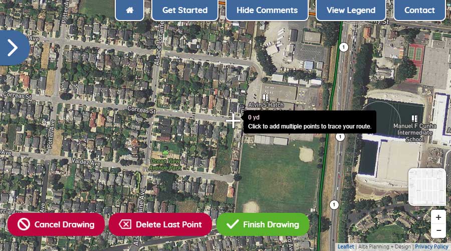
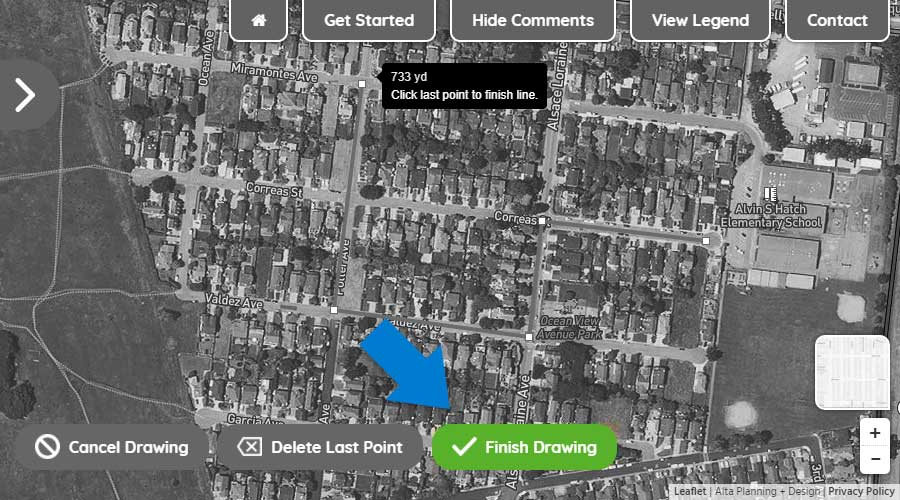
Step Two: With the first point drawn, continue by left-clicking or touching the map to show where you turn along your route.
Step Three: To move the map while drawing your route, hold down your left button on your mouse and move the mouse to get to your desired location on the map or simply drag the map with your fingers on your touchscreen. To zoom in and out, use the wheel on your mouse or use the +/- icons in the lower right of your screen.
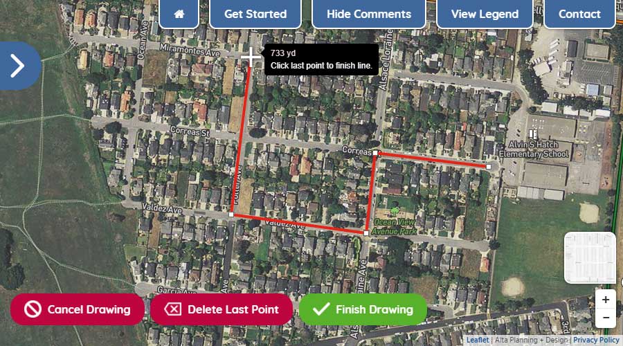
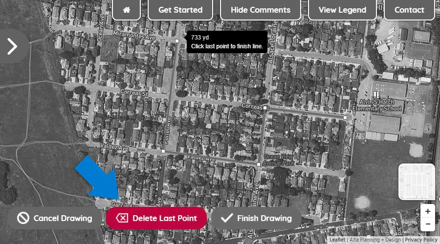
Step Four: To delete the last drawn point on your route, click the "Delete Last Point" button.
Step Five: To finish drawing your route, double click on the final point or click the "Finish Drawing" button.
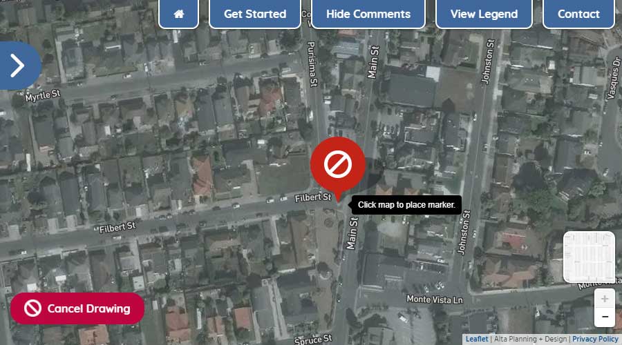
Using your mouse or touchscreen, left click on or touch the map to add a marker to the map.
Paved paths shared by people walking and rolling completely separated from motor vehicle traffic. Comfortable for people of all ages and abilities.
An on-street bike lane that is separated from motor vehicle traffic by a vertical barrier such as bollards, raised medians, planters, or parked cars.
A conventional bike lane paired with a buffer space that separates the bike lane from adjacent motor vehicle travel lane and/or parking lane.
Dedicated lane for bicycle travel adjacent to traffic. Separated from motor vehicle traffic or parking by painted line.
Signed bike route, sharing the roadway with motor vehicles on quiet neighborhood streets. Includes signs, street markings, and substantial traffic calming.
Bicycle Protected Intersections create physical separation between bicyclists and motor vehicles, improving safety and minimizing conflict between roadway users. They should be designed in such a way that they are intuitive to use, provide clear right-of-way assessment, and allow all roadway users to see each other as they move through the intersection.
Provide an area for people walking to travel separated from motor vehicle traffic. Typically constructed out of concrete and separated from the roadway by a curb or gutter and sometimes a landscaped buffer.
Advanced stop or yield bar markings are placed in advance of a crosswalk to discourage drivers from encroaching on the crosswalk.
In-street crossing signs reinforce the driver requirement to yield the right of way to pedestrians at designated pedestrian crossing locations.
High-visibility crosswalks are marked with thick bars, drawing additional attention and awareness to the crossing. In school zones, these crossings are yellow instead of the standard white color. Improvements can also include more crossing signage, advanced yield or stop bars, or visibility improvements.
Effective street lighting at pedestrian crossing locations increases vehicle operators' visibility of crosswalk and pedestrian users.
Median refuge islands help improve access for people walking by increasing visibility and allowing pedestrians to cross one direction of traffic at a time. Improve ease of crossing at mid- block locations.
Curb extensions minimize exposure for people crossing the street by shortening crossing distance and giving them a better chance to see and be seen before committing to crossing.
Curb ramps provide access between the sidewalk and roadway for people using wheelchairs, strollers, walkers, hand carts, bicycles, and for people who have trouble stepping up and down high curbs.
Leading Pedestrian Interval (LPI) gives a walk signal to pedestrian before the traffic signal turns green for vehicles. This allows pedestrian to enter the crosswalk before drivers start moving, increasing pedestrian visibility to turning drivers.
Rectangular Rapid Flash Beacons (RRFB) are a type of active warning beacon used at unsignalized crossings. They are designed to increase motor vehicle yielding compliance on multi-lane or high-volume roadways. Activated with a push-button.


